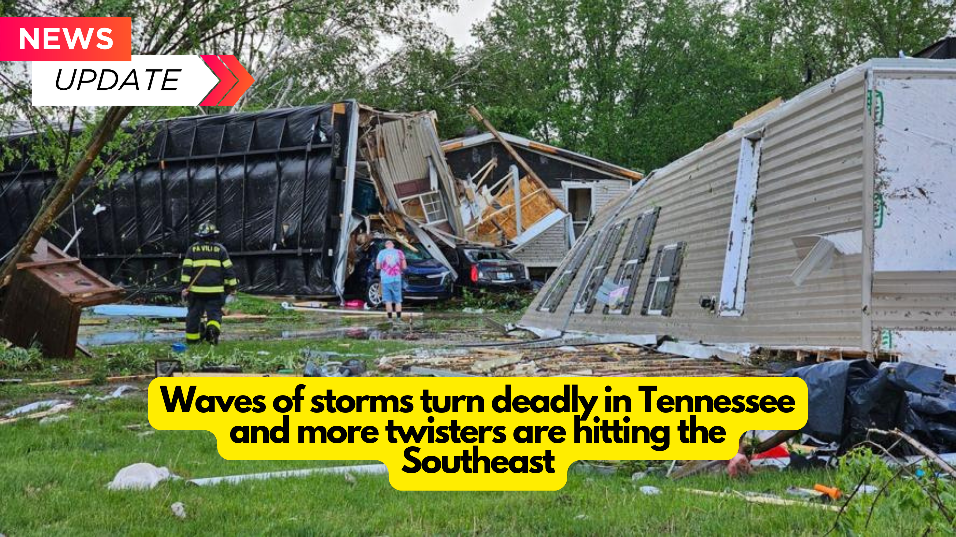
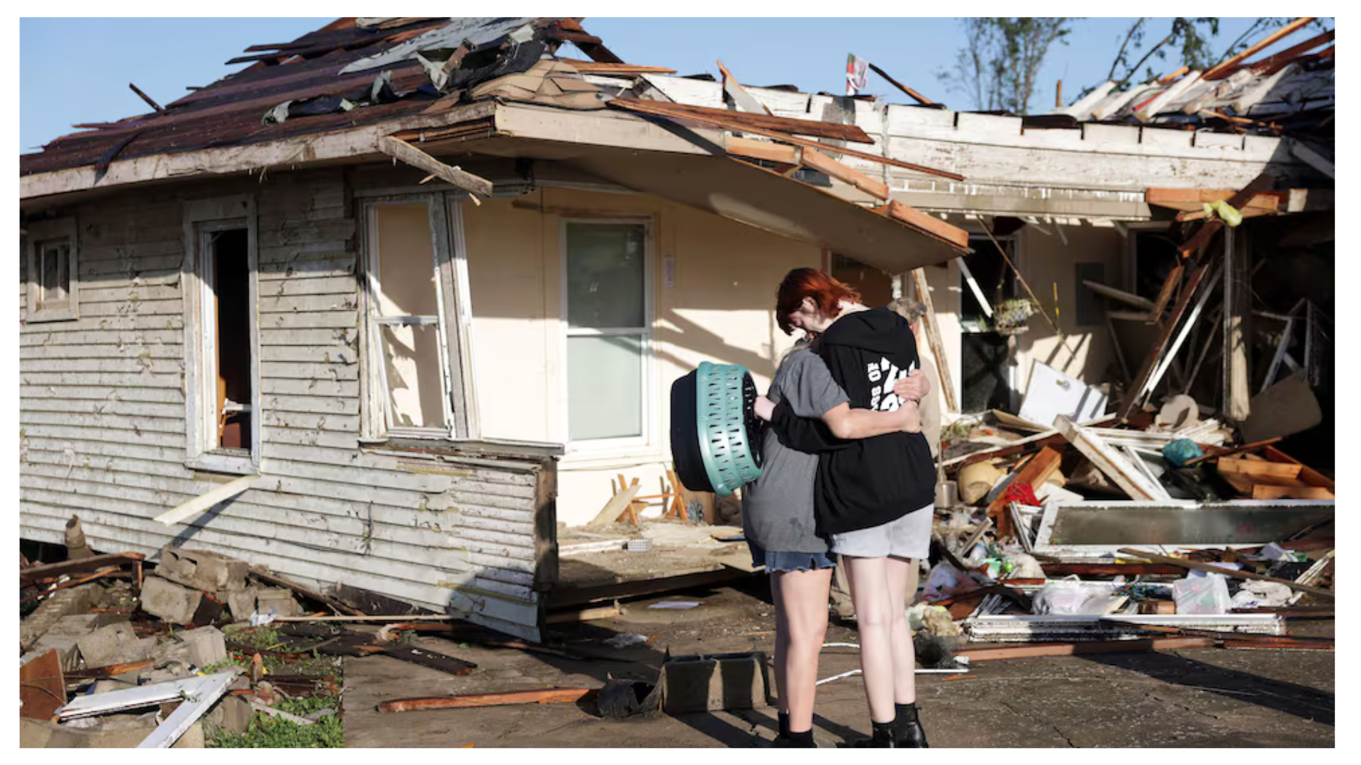
Strong storms swept over the central and eastern United States on Wednesday, killing at least two people in Tennessee, and as night set, flash floods and additional tornadoes pounded the state, including one that wreaked havoc in areas south of Nashville.
Tornado warnings were also in force late Wednesday in many southern states, including northern Alabama, where a “large and destructive tornado” was spotted near Henagar, a community of a few thousand people about 55 miles east of Huntsville, according to the National Weather Service. A tornado warning was issued early Wednesday night in the Huntsville area.
The National Weather Service has issued tornado watches for Alabama, Georgia, Arkansas, Mississippi, and Tennessee until 3 a.m. CT on Thursday. A tornado watch indicates that severe thunderstorms and tornadoes may occur in the watch region.
The National Weather Service reported four tornadoes in Tennessee on Wednesday, including two from Maury County, where a tornado alert was in effect. The meteorological service reported a “confirmed large and destructive tornado” near the city of Spring Hill about 5:50 p.m. CT.
Maury Regional Medical Center spokesman Rita Thompson told CNN that at least one person was killed and four people were injured in Maury County during the storm. Thompson said three of the patients had non-life-threatening injuries, while one was in severe condition.
“We urge everyone to remain off the roads. “If you can stay at home, do so,” the Maury County Office of Emergency Management wrote on Facebook.
According to the meteorological service, a flash flood emergency was declared Wednesday evening for Robertson and Sumner counties in Middle Tennessee, which are located near the Kentucky state line and about 20 to 30 miles north of Nashville.
“At 6:56 pm CDT, water rescues and very dangerous flooding are occurring in the emergency area,” forecasters stated. According to radar estimates, 4 to 7 inches of rain fell throughout these counties today, with additional heavy rain expected over the next several hours.
According to a spokesperson for the Robertson County Emergency Management Agency, there were a few water rescues, but no injuries were reported as of yet.
The first fatality from the storms was reported in Claiborne County, Tennessee, on Wednesday morning. According to the county’s emergency management agency, a tree fell on the person’s car during strong storms. The individual has not been identified.
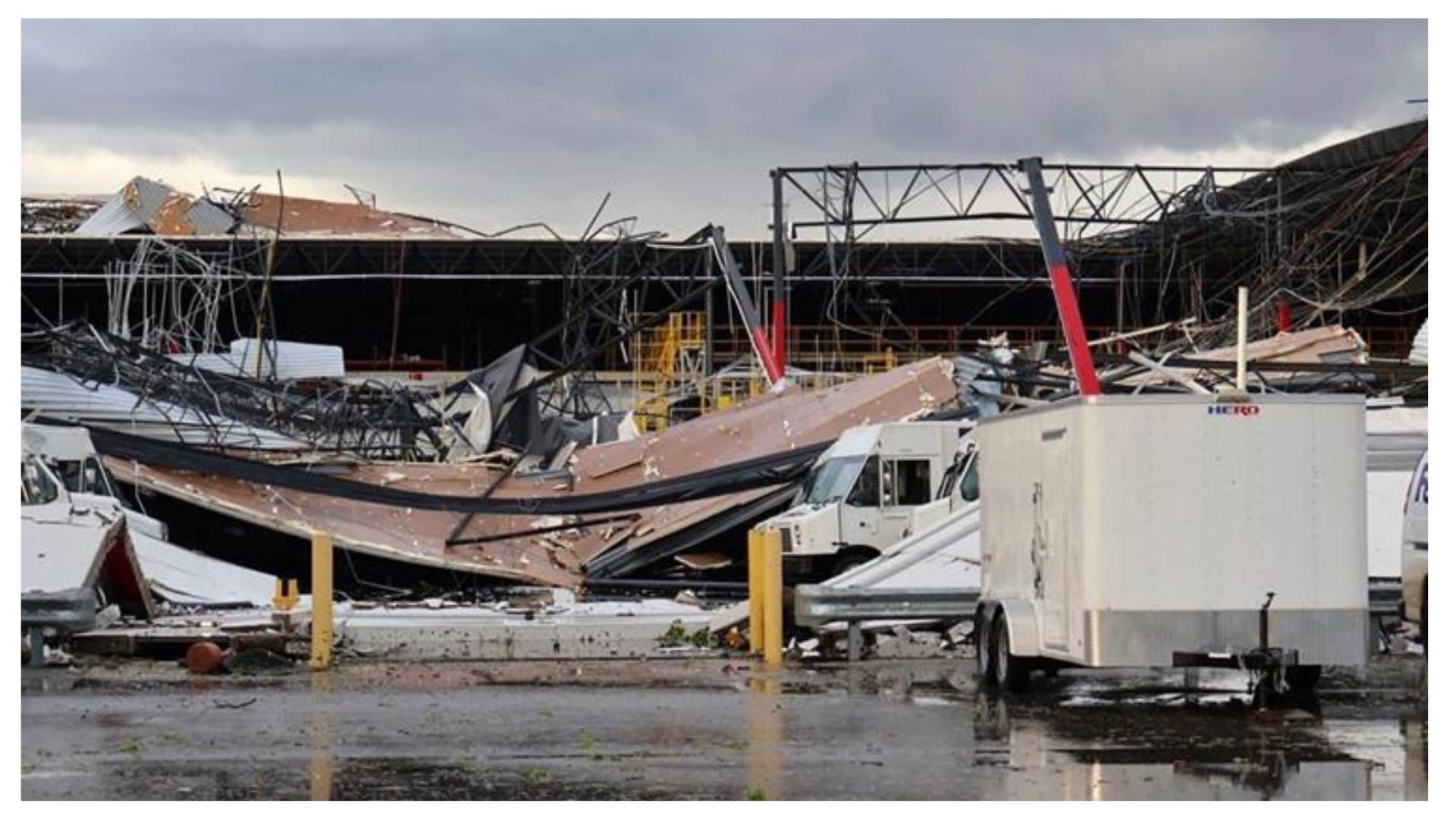
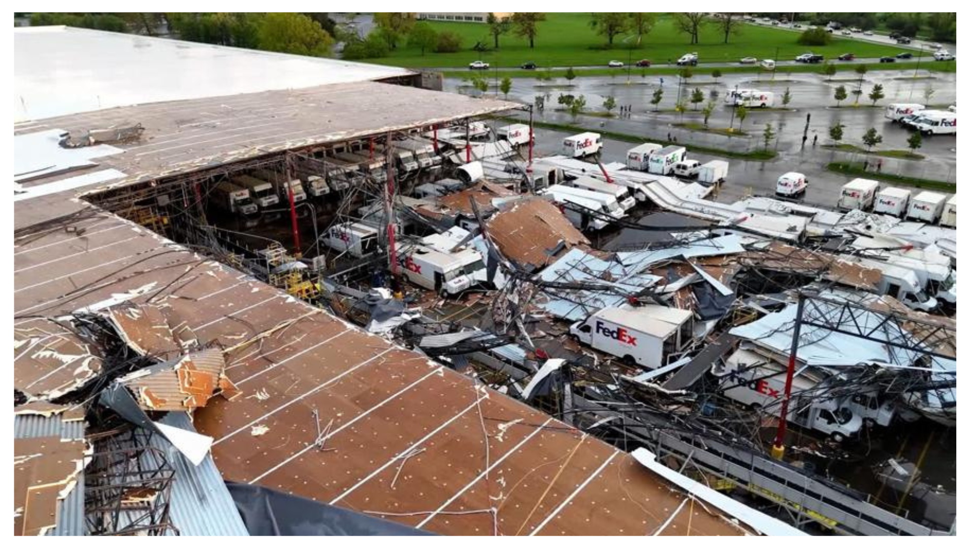
Dangerous storms with destructive winds, big hail, and tornado warnings have been in effect in numerous states since Wednesday morning. The severe weather comes only a day after violent tornadoes and storms ripped across southwestern Michigan, demolishing homes and businesses and injuring numerous citizens.
Severe weather is expected to move into the Southeast and Mid-Atlantic on Thursday, bringing additional hail, destructive winds, and the risk of a few tornadoes.
Here’s the most recent information on Wednesday’s storms and destruction in Tennessee, as well as Tuesday’s damage in Michigan.
The possibility of tornadoes persists on Wednesday.
According to the Storm Prediction Center, over 3.7 million people were in Level 4 or 5 danger of severe thunderstorms Wednesday night. This danger affects sections of Alabama, Missouri, Illinois, Kentucky, and Tennessee, including Nashville.
An additional 590 million people in Texas, the Ohio Valley, the mid-Atlantic, and the Northeast face a Level 2 or Level 3 danger.
Storms with devastating gusts, hail larger than baseballs, and tornado warnings have raged over many states since Wednesday morning.
Today’s forecast calls for strong thunderstorms
This map depicts areas where the National Weather Service has detected higher threats of severe weather, which may include thunderstorms, strong winds, hail, and tornadoes.
Some locations that had an initial wave of severe storms early Wednesday are in danger for another round later in the day, with Tennessee being a good example.
The repeated waves of storms on Wednesday will bring heavy rain and increase the risk of flooding.
“The greatest flash flooding threat also overlaps with the risk of severe thunderstorms, centered over Kentucky and Tennessee as well as sections of neighboring states,” according to the National Weather Service. The Weather Prediction Center has designated this area as having a Level 3 of 4 danger of flooding rains.
Rainfall rates might approach 2 inches per hour, significantly increasing the risk of flash floods. Locations impacted by numerous strong storms may receive more than 4 to 5 inches of rain.